Serving Customers Nationwide | In Business for Over 15 Years
Survey and Civil Engineering Software Programs That Meet Your Needs
Carlson Technology Solutions offers a comprehensive solution of Carlson desktop software for land development professionals working on data collection, surveying, engineering design, and drafting. You can purchase (own) programs that are tailored to your project's needs. Contact us for more information about our technology.
Carlson Software products are available either as
individual products
or you can
Bundle them and Save.
Carlson Software's Survey Suite
Software programs include:
- Carlson Survey
- Carlson Civil
- Carlson GIS
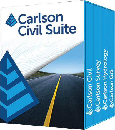
Carlson Civil Suite
The Ultimate Civil Package
- Carlson Civil
- Carlson Survey
- Carlson Hydrology
- Carlson GIS

Carlson Select Suite
- Carlson Civil
- Carlson Hydrology
- Carlson Survey
- Carlson GIS
- Carlson CADnet
- Carlson PointCloud
Carlson Survey
.png "Man Holding a Carlson BRx7")
The number one choice in the Surveying Industry.
Carlson Survey is designed to complement land surveying operations and provides a variety of survey features to process data from surface modeling to Least Squares Network Adjustment. Users work seamlessly between the office and the field by utilizing company-wide design styles for ease of use and efficiency.Choose your platform – Carlson Survey works on:■ IntelliCAD® (built-in)■ AutoCAD® OEM (built-in)■ AutoCAD® (sold separately)
Key Features
- Data Collection Interfaces
- Traverse Adjustment
- SurvNET
- Field-to-Finish
- Field-to-Finish Inspector
- COGO
- Coordinate Transformations
- Deeds
- Cut Sheets
Carlson civil

Robotic Total Stations
Top New Features
New Dual CAD/3D Viewer — check the design and adjust the
drawing at the same time
• Road NETwork Enhancements with support for rounded template
transitions and medians that cross the centerline
• Cleanup for Lot Linework that automatically finds any overshoots
or undershoots and highlights them
• New Footprint Creator — a library of different house footprints
• Road Rehabilitation command to create profiles for specified
overlay with milling or leveling.
• Command for Vehicle Path Tracking, which allows you to
trace wheel paths for vehicle dimensions along centerline.
• Edit Contours and instantly update the underlying 3D model
(updates the underlying TIN surface to match the modified contours),
Carlson’s Civil software provides fast and
intuitive civil engineering design capability
to visualize projects directly.
- Carlson offers choice
- AutoCAD® or IntelliCAD®
- Dynamic Design Environment
- 2D, 3D, or Flyover views
- Affordable upgrades
Get Powerful Automation
What might take days with other civil software takes just
hours, or even minutes, with the powerful, intuitive Carlson
Civil.
Road NETwork. Build all roads, intersections and cul-de-sacs
in 2D and 3D with a single click of the “PROCESS” button.
Site NETwork. Elevate your estimating accuracy with this
intuitive layer-based surface generator and earthwork
calculator.
Lot NETwork. Quickly define an entire subdivision of lots
based on an outer boundary, interior ROWs or Centerlines,
and a simple set of user-defined “rules,” then pick “PROCESS”
and the lots appear, defined and labeled.
Contact us to learn about our current specials.
Carlson GIS
.png "image title")
Put Your Designs on the Map
Advanced Technology
Providing tools for data capture and linking, data labeling, import/export of SHP files, polygon topology creation and analysis, and more, Carlson GIS is an awesome GIS “Swiss Army Knife” for the surveyor or engineer. The routines for managing aerial images enable users to improve the quality of the geographic positioning of their designs.
Other attributes include ability to:
- Import images and terrain from both Google Earth and Esri®
- Activate a geolocated background map
- Import GIS layers as linework with GIS data with Web Feature Service (WFS)
- Use Web Map Service (WMS) to place images from Carlson Image Server or user-specified server
With Carlson GIS’ powerful GIS automation, users can input, edit,
label, inspect, and report GIS data to entities via simple tools, in
addition to obtaining topographic and planimetric features from
county databases.
.png "Man Holding a Carlson BRx7")
Carlson Hydrology provides a system-wide stormwater solution in3D, offering enhanced 3D options plus a command to run multiple rain events at the same time. The software also provides warnings for collisions, excessive pipe lengths, insufficient cover, lack of slope, excessive flow rates, and more.
Carlson Hydrology
Complete Hydrologic & Hydraulic Solution
Comprehensive, yet easy-to-master, Carlson
Hydrology provides the automation to meet your
hydrology needs and all in the CAD environment
of polylines, text, and layers. Full 3D road and lot
design feed directly into flow calculations and drainage design.
Top attributes include :
- Site Drainage-using either Rational or SCS Method
- Runoff Analysis to determine watershed area, time of concentration and peak flow rates
- Storm Drain System design and drafting
- Pond, culvert, channels, and outlet design and sizing
- Extensive libraries on rainfall, inlets, manholes, outlets
Carlson CADNet
.png "image title")
Carlson CADnet allows users to create CAD from non-CAD documents such as PDFs, raster images, and paper plans. CAD text can also be generated from raster images with CADnet's built-in Optical Character Recognition (OCR).
Carlson CADnet users get the ability to import BIM models (doors, windows, walls, roofs, etc.) and bring them into CAD as CAD entities; plus CADnet includes a routine to export surfaces into BIM. Users can import PDF files as well as BIM using IFC files; convert raster images to vector CAD entities; and, modify Raster images using cut, copy, remove speckles and thicken commands. Project setup is easy with flexible data storage methods. CADnet incorporates handy tools for working in AutoCAD such as Join Nearest, Shrinkwrap Entities, Polyline Utilities, Drawing Inspector, Layer Inspector, and Twist Screen. Carlson office software solutions all come with IntelliCAD® built-in and work on AutoCAD®. Carlson CADnet is part of the Carlson Takeoff R-series, which comes as a full AutoCAD OEM.
Carlson PhotoCapture
Advanced Photogrammetry


Powerful Features:
- View and edit your 3D map immediately after processing
- Tools to generate surface models/TINs, filter to bare earth for topo, annotations, breaklines, and much more
- Convert imagery into survey-grade 3D surface models and point clouds
- LiDAR + Imagery workflow integrates the best aspects of both technologies
- Set control points to fine-tune the accuracy of your survey data
- Get topographic elevations of landscape features with just a click
- Show your 3D job site to customers and employees with our web app
- Instantly calculate the volume of any feature


